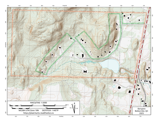
Батурин#
Color “USGS style” Topo#
Mimics color schemes and symbols used in the popular and familiar USGS topo map series.
Black & White Topo#
Optimized for inexpensive black and white printing. Should hold up to photocopying as well.
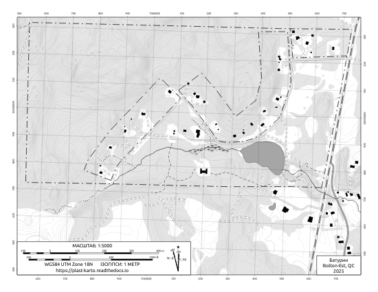
Page Size |
Map Scale |
|
|---|---|---|
8.5 x 11 (Letter) |
1:5000 |
Corner Ruler UTM Grid Tool#
Measure & plot UTM coordinates. This “roamer style” grid tool kit is custom-made to include rulers for the 1:5000 scale used in the Батурин map.
- Instructions:
Print out onto 8.5x11 transparency film
Cut out individual grid tools
Punch out the three small pencil-holes (use a nail or drill)
Punch out the lanyard hole with a standard hole punch
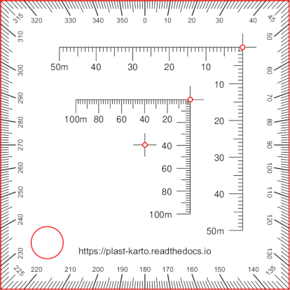
Cut marks shown in red#
Data Sources and Attributions#
Map author: Олесь Микита
On-site surveys:
Олесь Микита - GPS tracks.
Imagery and LiDAR datasets:
Parcel Boundaries: